Por favor, use este identificador para citar o enlazar a este item:
http://hdl.handle.net/10261/225483COMPARTIR / EXPORTAR:
 SHARE
BASE SHARE
BASE
|
|
| Visualizar otros formatos: MARC | Dublin Core | RDF | ORE | MODS | METS | DIDL | DATACITE | |

| Título: | Disentangling human-induced x natural sediment resuspension events in Barkley Canyon, NE Pacific, using cabled observatory, mooring and vessel AIS data |
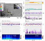
Autor: | de Leo, Fabio; Garner, Grant; Puig, Pere CSIC ORCID ; Paradis Vilar, Sarah CSIC ORCID | Fecha de publicación: | 19-feb-2020 | Citación: | Ocean Sciences Meeting (2020) | Resumen: | Ocean Networks Canada (ONC) operates large seafloor cabled observatories in the Arctic and NE Pacific, with some of its long-term observations nearly approaching 15 years of archived data. The seafloor network of 850+ km of backbone cables connects > 50 instrumented sites (>400 oceanographic instruments, >5,000 sensors), in habitats ranging from temperate coastal fjords, ice-covered Arctic bays, to deep-sea canyons, abyssal plains and hydrothermal vents. In 2016, ONC initiated a new monitoring program aiming at studying sediment transport processes off the shelf and slope of Vancouver Island, British Columbia. This area is targeted by a commercial bottom trawling fishery of rockfish. Bottom trawling is pervasive along the world’s continental shelves and slopes, and known for triggering sediment resuspension due to the physical contact of heavy fishing gear to the seafloor. Three moorings were deployed near the head, northern flank and axis of Barkley Canyon (BC), equipped with turbidity sensors, current meters and sediment traps, with the objective of capturing sediment resuspension plumes attributed to fishing, and its potential transport via BC. The NEPTUNE cabled observatory provided additional environmental context with long-term observations of bottom currents and turbidity. Automatic Information System (AIS) vessel tracking data was used to determine the extent of the ‘fishing ground footprint’ near BC, and to serve as ground-truthing for the mooring data. Sea surface meteorological and oceanographic conditions (namely wind speed/direction and significant wave height/period) were obtained from the La Perouse buoy station in order to establish the shelf and upper slope natural variability of storm-induced sediment resuspension events. Our preliminary results identified the seasonal patterns of fishing activity with vessels concentrating in and around BC mostly in May and June, with clear signals of fishing-induced resuspension events, in particular at the head of the canyon | Descripción: | Ocean Sciences Meeting (OSM), 16-21 February 2020, San Diego, CA, USA | Versión del editor: | https://doi.org/10.13140/RG.2.2.25252.09605 | URI: | http://hdl.handle.net/10261/225483 | DOI: | 10.13140/RG.2.2.25252.09605 |
| Aparece en las colecciones: | (ICM) Comunicaciones congresos |
Ficheros en este ítem:
| Fichero | Descripción | Tamaño | Formato | |
|---|---|---|---|---|
| De_Leo_et_al_2020_poster.pdf | 2,6 MB | Adobe PDF |  Visualizar/Abrir | |
| de_Leo_et_al_2020.png | 998,41 kB | image/png |  Visualizar/Abrir |
CORE Recommender
Page view(s)
120
checked on 23-abr-2024
Download(s)
55
checked on 23-abr-2024
Google ScholarTM
Check
Altmetric
Altmetric
NOTA: Los ítems de Digital.CSIC están protegidos por copyright, con todos los derechos reservados, a menos que se indique lo contrario.
