Por favor, use este identificador para citar o enlazar a este item:
http://hdl.handle.net/10261/319654COMPARTIR / EXPORTAR:
 SHARE
BASE SHARE
BASE
|
|
| Visualizar otros formatos: MARC | Dublin Core | RDF | ORE | MODS | METS | DIDL | DATACITE | |

| Título: | Marine GIS Applications: GIS Spanish Institute of Oceanography |
Autor: | Tello-Antón, María Olvido; Hermida-Jiménez, Nuria; Pastor-García, Elena; Sanz-Alonso, José Luis | Palabras clave: | Medio Marino Marine environment Sede Central IEO GIS Resources marine Marine ecosystems Protection Management Spatial analysis Mapping |
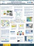
Fecha de publicación: | 25-sep-2014 | Citación: | SIEBM XVIII BIOLOGIA MARINA (2014) | Resumen: | Since 1998 in the IEO is developing a MARINE GIS with the objective of organize, harmonize, standardize, integrated the geo-information of IEO. GIS tools are used in several projects carried out in the IEO related to study of living resources, natural resources, studies of evolution of natural phenomena, collecting data, marine spatial planning, etc. | Descripción: | Poster presentado en el SIEBM XVIII Simposio Ibérico de Biología Marina | URI: | http://hdl.handle.net/10261/319654 |
| Aparece en las colecciones: | (IEO) Comunicaciones congresos |
Ficheros en este ítem:
| Fichero | Descripción | Tamaño | Formato | |
|---|---|---|---|---|
| poster_ota55_eng_fin_siemb.pdf | Poster | 7,56 MB | Adobe PDF |  Visualizar/Abrir |
CORE Recommender
Este item está licenciado bajo una Licencia Creative Commons

