Por favor, use este identificador para citar o enlazar a este item:
http://hdl.handle.net/10261/287027COMPARTIR / EXPORTAR:
 SHARE
BASE SHARE
BASE
|
|
| Visualizar otros formatos: MARC | Dublin Core | RDF | ORE | MODS | METS | DIDL | DATACITE | |

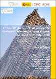
| Título: | Geological mapping as a tool for scientific research: Group of Geological, Geomorphological and 4D Geology Cartography of Mountain Ranges and Basins |
Autor: | Robador Moreno, Alejandro; Díez Fernández, Rubén; Díez Montes, Alejandro; Gonzalo Guerra, Brais; Heredia, Nemesio CSIC ORCID CVN ; Mancebo Mancebo, María Jesús; Montes Santiago, Manuel Jesús; Rodríguez Fernández, Luis Roberto; Romero Canencia, Gloria; Rubio Pascual, Francisco Javier | Palabras clave: | Cartografía geológica IGME |
Fecha de publicación: | 2022 | Editor: | CSIC - Instituto Geológico y Minero de España (IGME) | Citación: | Proceedings : 1st Scientific-Technical Conference of the Geological and Mining Institute of Spain-National Center (IGME, CSIC): 45-49 (2022) | Resumen: | [EN] The GI-CARTO research group is articulated around geological mapping as a research methodology developed in many projects. The activities of the team can be distributed in various working lines: 1.-Research activities devoted to the solving of specific geological problems 2.-Systematic geological mapping 3.-Implementation of a new geological information model 4.-Edition and preparation of new geological maps 5.-International activitie | Versión del editor: | https://doi.org/10.5281/zenodo.7092555 | URI: | http://hdl.handle.net/10261/287027 | DOI: | 10.5281/zenodo.7092555 |
| Aparece en las colecciones: | (IGME) Libros y partes de libros |
Ficheros en este ítem:
| Fichero | Descripción | Tamaño | Formato | |
|---|---|---|---|---|
| Proceedings_I-Jornadas CT-IGME_2022.pdf | Resumen | 6,43 MB | Adobe PDF |  Visualizar/Abrir |
CORE Recommender
Page view(s)
70
checked on 22-may-2024
Download(s)
34
checked on 22-may-2024
Google ScholarTM
Check
Altmetric
Altmetric
Este item está licenciado bajo una Licencia Creative Commons

