Por favor, use este identificador para citar o enlazar a este item:
http://hdl.handle.net/10261/179856COMPARTIR / EXPORTAR:
|
|
|
| Visualizar otros formatos: MARC | Dublin Core | RDF | ORE | MODS | METS | DIDL | DATACITE | |

| Título: | High resolution seismic characterization of the shallow subsurface of the Loranca Basin (Spain): high resolution 3D |
Otros títulos: | VICANAS 3D | Autor: | Marzán, Ignacio ; Martí, David CSIC ORCID ; Torné, Montserrat CSIC ORCID ; Ruiz Fernández, Mario CSIC ORCID ; Carbonell, Ramón CSIC ORCID | Palabras clave: | Seismic:Active:MCS-3D DigitalSeg SEGY Seismic:Velocity Seismometer_SingleFrequency SeismicSource_Accelerated weight drop |
Fecha de publicación: | 30-ene-2014 | Editor: | DIGITAL.CSIC | Citación: | Marzán, Ignacio; Martí, David; Torné, Montserrat; Ruiz Fernández, Mario; Carbonell, Ramón. High resolution seismic characterization of the shallow subsurface of the Loranca Basin (Spain): high resolution 3D. 2014. DIGITAL.CSIC. http://dx.doi.org/10.20350/digitalCSIC/8636 | Resumen: | A high-resolution seismic tomography survey was acquired to obtain a full 3-D P-wave seismic velocity image of the Záncara river basin (eastern Spain). The study area consists of lutites and gypsum from a Neogene sedimentary sequence. The project also targeted the geometry of the underground structure with emphasis on defining the lithological contacts but also the presence of cavities and faults or fractures. An extensive drilling campaign provided uniquely tight constraints on the lithology; these included core samples and wireline geophysical measurements. The analysis of the well log data enabled the accurate definition of the lithological boundaries and provided an estimate of the seismic velocity ranges associated with each lithology. The final joint interpreted image reveals a wedge-shaped structure consisting of four different lithological units. The study features the necessary key elements to test the travel time tomographic inversion approach for the high-resolution characterization of the shallow surface. In this methodological validation test, travel-time tomography demonstrated to be a powerful tool with a relatively high capacity for imaging in detail the lithological contrasts of evaporitic sequences located at very shallow depths, when integrated with additional geological and geophysical data. | Descripción: | The data acquisition contract was awarded to ENRESA and took place in January 2014. Seismic data was successfully collected in the Záncara river basin (Cuenca, Spain). This is a high-resolution seismic tomography survey to obtain a full 3-D P-wave seismic velocity image of the studied area. A regular and dense grid of 676 shots and 1200 receivers was used to image a 500 m x 500 m area of the shallow surface. A 240-channel system and a seismic source, consisting of an accelerated weight drop, were used in the acquisition. Half a million travel-time picks were inverted to provide the 3-D seismic velocity distribution up to 120 m depth. The 3-D survey was acquired in five swaths, each one consisting on five receiver lines, resulting in a total of 3380 shot gathers. Technical specifications of the profiles: Receiver number: 240, Receiver interval: 2 m, Source accelerated weightdrop: 250 kg, Source interval: 6 m, Sample rate: 1 ms, Record time: 4 s. In this repository, in addition to the seismic 3DSurvey, a resistivity model (VICANAS_3D_Res_UTM30), a lithological model (VICANAS_3D_Vp_Res_Lito_UTM30), and a training set (VICANAS_Training_set) are available. In order to improve the geological interpretation of the seismic tomography, we integrated it with the resistivity model to build a 3D lithological model. To this aim, we created a new bi-parameter grid with Vp and Res values at each node. Then, we lithologically classified the nodes using supervised learning according to a training set extracted from the wells. |
URI: | http://hdl.handle.net/10261/179856 | DOI: | 10.20350/digitalCSIC/8636 | Referencias: | Martí, D.; Marzán, I.; Sachsenhausen, J.; Ruiz, M.; Torné, M.; Mendes, M.; Carbonell, R. (2019) 3-D seismic travel-time tomography validation of a detailed subsurface model: the case study of the Záncara River (Cuenca, Spain). Solid Earth, 10, 177-192. https://doi.org/10.5194/se-10-177-2019 Marzán, I., Martí, D., Álvarez-Marrón, J., Lobo, A., Ruiz, M., Torné, M., and Carbonell, R. (2018). Detailed 3D subsurface geophysical model: data integration, multi-parameter inversion and statistical integrated interpretation: the case study of the Zancata River Basin (Cuenca, Spain). International Symposium on Deep Earth Exploration and Practices, Beijing, China. Acta Geologica Sinica Vol. 92, Supp. 1. https://doi.org/10.1111/1755-6724.14099 Carbonell, R., Marzán, I., Martí, D., Lobo, A., Jean, K., and Álvarez-Marrón, J. (2016). Detailed 3D geophysical model of the shallow surface (Záncara River Basin, Iberian Peninsula). American Geoscience Union, Fall Meeting, NS33B-1974. http://adsabs.harvard.edu/abs/2016AGUFMNS33B1974C Martí, D., Marzán, I., Kormann, J., Álvarez-Marrón, J., and Carbonell, R., (2016). Shallow subsurface 3-D seismic velocity structure (Záncara river basin, Iberian Peninsula). 17th International Seismix (International Symposium on Deep Seismic Profiling of the Continents and their Margins) Symposium: 104. Scotland, United Kingdom. https://digital.csic.es/handle/10261/150411 Marzán, I., Martí, D., Lobo, A., Kormann, J., Álvarez-Marrón, J., and Carbonell, R., (2016). Geophysical data integration for a joint interpretation in a shallow gypsiferous context. 17th International Seismix (International Symposium on Deep Seismic Profiling of the Continents and their Margins) Symposium: 107. Scotland, United Kingdom. http://digital.csic.es/handle/10261/149970 Marzán, I., Martí, D., Lobo, A., Kormann, J., Álvarez-Marrón, J., and Carbonell, R., (2016). Interpretación conjunta de modelos de velocidad y resistividad 3D mediante clasificación estadística. Geotemas 16 (1): 507-510. ISSN 1576-5172. Sociedad Geológica de España, IX Congreso Geológico de España, Huelva. http://digital.csic.es/handle/10261/147678 Martí, D., Marzán, I., Álvarez-Marrón, J., and Carbonell, R. (2016). Testing & Validating: 3D seismic travel time tomography (detailed shallow subsurface imaging). Geophysical Research Abstracts Vol. 18: EGU2016-7836-1. https://digital.csic.es/handle/10261/150368 Marzán, I., Martí, D., Lobo, A., Álvarez-Marrón, J. and Carbonell, R. (2016). Seismics-electrics Joint Interpretation in a gypsiferous context. Geophysical Research Abstracts Vol. 18: EGU2016-8062-1. https://digital.csic.es/handle/10261/150482 Kormann, J.A., Martí, D., Rodríguez, J. E., Marzán, I., Gutiérrez, N., Ferrer, M., Hanzich, M., de la Puente, J., Carbonell, R., Cela, J. M. and Fernández, S. (2016). 3D elastic full waveform inversion - on land study case. 78th European Association of Geoscientists & Engineers (EAGE) Conference and Exhibition 2016, Tu SRS2 08. Viena, Austria. doi: 10.3997/2214-4609.201600831. http://hdl.handle.net/2117/87763. https://doi.org/10.3997/2214-4609.201600831 Martí, D., Marzán, I., Sachsenhausen, J., Álvarez-Marrón, J., Cienfuegos, I., and Carbonell, R. (2015). High-resolution Seismic Characterization of the Shallow Subsurface Applied to Civil Engineering . 77th European Association of Geoscientists & Engineers (EAGE) Conference and Exhibition 2015, WS03-B01. Madrid. https://doi.org/10.3997/2214-4609.201413471. http://www.earthdoc.org/publication/publicationdetails/?publication=81311 Sendin Manchado, S. (2015). Integrated 3D geophysical study of the shallow subsurface of the Zancara River Basin (Cuenca, Spain). Master Thesis, ICTJA-CSIC. http://digital.csic.es/handle/10261/140131 Carbonell, R., Martí, D., Marzán, I., and Álvarez-Marrón, J. (2015). Seismic tomography: exploring the shallow surface (case history studies). Invited Talk, Department of Geology, Kyungpook National University, Daegu, Korea. Sachsenhausen, J., Martí, D., Marzán, I., Cienfuegos, I., Álvarez-Marrón, J., Carbonell, R., and Pérez-Estaún, A. (2014). High-resolution 3D velocity model from seismic tomography in the Záncara river basin (Cuenca, Iberian Peninsula). 16th Edition of the Deep SEISMIX International Symposium on Multi-scale Seismic Imaging of the Earth's crust and Upper Mantle. Castelldefels, Barcelona. https://doi.org/10.13140/2.1.4828.1923. Sachsenhausen, J. (2014). Determination of 3D velocity model through seismic tomography in the Záncara River Basin (Cuenca, Iberian Peninsula). Master Thesis. |
| Aparece en las colecciones: | (Geo3Bcn) SeisDARE |
Ficheros en este ítem:
| Fichero | Descripción | Tamaño | Formato | |
|---|---|---|---|---|
| Descripcion_ficheros_VICANAS 3D_August 2020.xlsx | August 2020_List of the files included in this dataset | 9,74 kB | Microsoft Excel XML | Visualizar/Abrir |
| Readme_VICANAS 3D-August 2020.txt | August 2020_Dataset general information | 3,46 kB | Text | Visualizar/Abrir |
| Index card_VICANAS 3D.pdf | Index card summarizing the main characteristics of the dataset | 9,26 MB | Adobe PDF | 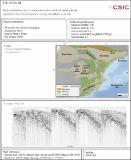 Visualizar/Abrir |
| 3D_GEOMETRY.tar | Geographic coordenates of receivers, sources and swaths | 210 kB | Text | Visualizar/Abrir |
| 3DSURVEY_map.png | Geometry of the acquisition experiment | 856,17 kB | PNG |  Visualizar/Abrir |
| 3DSurvey_SEGY.tar | Swath segy files | 8,43 GB | SEGY | Visualizar/Abrir |
| 3DSurvey.tar | Raw data lines | 17 GB | SEGY | Visualizar/Abrir |
| VICANAS_3D_Res_UTM30.csv | August 2020_3D model of electrical resistivity | 1,58 MB | CSV | Visualizar/Abrir |
| VICANAS_3D_Vp_Res_Lito_UTM30.csv | August 2020_3D lithological model of the subsurface under the target site. | 778,58 kB | CSV | Visualizar/Abrir |
| VICANAS_Training_set.csv | August 2020_Training set used to classify the bi-parametric grid resulting from the integration of the P-wave velocity and electrical resistivity models. | 4,14 kB | CSV | Visualizar/Abrir |
| VICANAS-acquisitionMAP_Vp_Resisitvity_Wells.png | August 2020 | 1,46 MB | image/png |  Visualizar/Abrir |
CORE Recommender
Page view(s)
788
checked on 19-abr-2024
Download(s)
303
checked on 19-abr-2024

Google ScholarTM
Check
Altmetric
Altmetric
Este item está licenciado bajo una Licencia Creative Commons
