Por favor, use este identificador para citar o enlazar a este item:
http://hdl.handle.net/10261/170518COMPARTIR / EXPORTAR:
|
|
|
| Visualizar otros formatos: MARC | Dublin Core | RDF | ORE | MODS | METS | DIDL | DATACITE | |

| Título: | Enhanced retrieval of the geophysical signature of SMOS SSS maps |
Autor: | Olmedo, Estrella CSIC ORCID ; Martínez, Justino CSIC ORCID ; Turiel, Antonio CSIC ORCID ; Ballabrera-Poy, Joaquim CSIC ORCID ; Portabella, Marcos CSIC ORCID | Fecha de publicación: | 20-jul-2016 | Editor: | Universidad de Alicante | Citación: | Libro de Resúmenes. IV Encuentro Oceanografía Física Española: 90-91 (2016) | Resumen: | The Soil Moisture and Ocean Salinity (SMOS) mission has provided a unique remote sensing platform capability for observing key variables of the hydrological cycle, such as the Sea Surface Salinity (SSS). However, due to some limitations related to the instrument interferometric concept and its challenging data processing, SMOS SSS maps still display significant artifacts and biases, especially close to the coast due to the presence of Radio Frequency Interferences (RFI) and Land-sea contamination (LSC). A new methodology for filtering salinity retrievals and correcting for spatial biases is introduced and validated here | Descripción: | IV Encuentro Oceanografía Física Española, celebrado del 20 al 22 de julio de 2016 en Alicante,España.-- 2 pages, 2 figures | Versión del editor: | http://rua.ua.es/dspace/handle/10045/59211 | URI: | http://hdl.handle.net/10261/170518 | Identificadores: | isbn: 978-84-16724-17-8 |
| Aparece en las colecciones: | (ICM) Comunicaciones congresos |
Ficheros en este ítem:
| Fichero | Descripción | Tamaño | Formato | |
|---|---|---|---|---|
| Olmedo_et_al_2016.pdf | 202,11 kB | Adobe PDF | 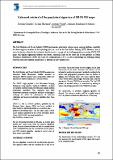 Visualizar/Abrir |
CORE Recommender
Page view(s)
329
checked on 22-abr-2024
Download(s)
97
checked on 22-abr-2024

Google ScholarTM
Check
Este item está licenciado bajo una Licencia Creative Commons
