Por favor, use este identificador para citar o enlazar a este item:
http://hdl.handle.net/10261/151293COMPARTIR / EXPORTAR:
|
|
|
| Visualizar otros formatos: MARC | Dublin Core | RDF | ORE | MODS | METS | DIDL | DATACITE | |

| Título: | GIS approximation of how land use/cover changes affect the hydrological system in a Mediterranean mountain catchment |
Autor: | Lizaga Villuendas, Iván CSIC ORCID ; Quijano Gaudes, Laura CSIC ORCID ; Palazón Tabuenca, Leticia CSIC ORCID ; Gaspar Ferrer, Leticia CSIC ORCID ; Navas Izquierdo, Ana CSIC ORCID | Fecha de publicación: | jun-2016 | Citación: | XIV Reunión Nacional de Geomorfología (Málaga. 22-25 junio 2016) | Resumen: | Sediment connectivity has an important effect on the development of morphological landform features being one of the greatest conditioning factors on the development of hydrological networks. The steep slope agriculture has affected connectivity during the last centuries in Mediterranean landscapes. Our objective is to assess the variation of connectivity produced by land cover changes during the last 50 years in a mountain catchment. | Descripción: | 1 .pdf copia del póster original (119 x 84 cm.) presentado por los autores. Attribution-NonCommercial-NoDerivatives 4.0 International (CC BY-NC-ND 4.0). | URI: | http://hdl.handle.net/10261/151293 |
| Aparece en las colecciones: | (EEAD) Comunicaciones congresos (MNCN) Comunicaciones congresos |
Ficheros en este ítem:
| Fichero | Descripción | Tamaño | Formato | |
|---|---|---|---|---|
| QuijanoL_XIVReunNalGeomorf_2016.pdf | 3,2 MB | Adobe PDF | 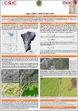 Visualizar/Abrir |
CORE Recommender
Page view(s)
220
checked on 24-abr-2024
Download(s)
94
checked on 24-abr-2024

Google ScholarTM
Check
Este item está licenciado bajo una Licencia Creative Commons
